
Syracuse ZIP Code Coverage
Syracuse uses many delivery ZIPs, but a postal city name is not proof that a parcel lies in the City of Syracuse. The county's generalized map identifies the usual city-area pattern, while the Postal Service assigns the definitive ZIP for a complete address. The table keeps standard delivery areas separate from special mailing labels because the official capture did not establish the service class of every special code.
| ZIP | Areas or likely geography | Service note | Boundary or search note |
|---|---|---|---|
| 13201 | Central-post-office or PO-box-style code | Syracuse postal designation | Exact service class was not located; verify the address. |
| 13202 | Downtown, central Syracuse, civic and urban core | Syracuse delivery area | Generalized city-area ZIP; USPS controls house-level result. |
| 13203 | North and east-central Syracuse | Syracuse delivery area | GIS and city boundaries can differ from the postal area. |
| 13204 | West and near-west Syracuse, including the civic corridor | Syracuse delivery area | County map is approximate. |
| 13205 | South Syracuse | Syracuse delivery area | Use USPS for the specific house. |
| 13206 | Eastwood and east Syracuse | Syracuse delivery area | Nearby town mailing addresses may differ. |
| 13207 | South and east-south Syracuse | Syracuse delivery area | Does not identify a ward or engagement sector. |
| 13208 | Northside and north Syracuse | Syracuse delivery area | Parcel boundary remains a GIS and legal question. |
| 13209 | West Syracuse and western county-edge mailing area | Syracuse or Solvay-area designation | Can cross city, town, or village lines. |
| 13210 | University and east-central Syracuse | Syracuse delivery area | Institutional or PO addresses can have special handling. |
| 13211 | North and east-north Syracuse | Syracuse delivery area | Exact boundary comes from USPS. |
| 13212 | North Syracuse and Salina-area mailing geography | Syracuse postal designation | May be outside city limits. |
| 13214 | DeWitt and east-of-city mailing area | Syracuse postal designation | Important city-versus-county mismatch. |
| 13215 | South and east county, plus Syracuse mailing geography | Syracuse postal designation | Verify with USPS and the municipal parcel map. |
| 13217 | Special Syracuse postal code | Syracuse mailing label | Official classification and boundary were not located. |
| 13218 | Special Syracuse postal code | Syracuse mailing label | Official classification and boundary were not located. |
| 13219 | West Syracuse and western county mailing geography | Syracuse postal designation | Check City, Geddes, Solvay, or another municipality. |
| 13220 | Special or unique Syracuse code | Syracuse mailing label | Not safe to map as a city polygon. |
| 13221 | Special Syracuse postal code | Syracuse mailing label | Official classification was not located. |
| 13224 | East Syracuse, university-adjacent, and east-side geography | Syracuse delivery area | Exact parcel boundary needs USPS and GIS. |
| 13225 | Special Syracuse postal code | Syracuse mailing label | Verify by full address. |
| 13235 | Special Syracuse postal code | Syracuse mailing label | Verify by full address, not city limits. |
| 13244 | Special Syracuse postal code | Syracuse mailing label | Unique or institutional use needs USPS confirmation. |
| 13250 | Special Syracuse postal code | Syracuse mailing label | Do not treat as a standard residential polygon. |
| 13251 | Special Syracuse postal code | Syracuse mailing label | Verify by full address. |
| 13261 | Federal-building or government mailing designation | Syracuse postal designation | Not evidence of a neighborhood or household. |
Local references identify 13202 through 13212, 13214, 13215, 13219, and 13224 as the standard city-area set. That is a useful orientation list, not a city-limits list. The rows for 13201 and the special labels deliberately retain the documented uncertainty instead of assigning a PO-box or unique-code class that was not verified in the official material.
Verify a Syracuse ZIP Address
Use the USPS ZIP Code Lookup with the complete street address, city, and state when an exact delivery ZIP matters. USPS explains in its ZIP Code basics that its delivery areas do not necessarily track municipal lines. A short city label, a map pin, or a ZIP in an old record is not the final answer.
The Onondaga County generalized ZIP map is still useful for orientation. Its caption expressly says it is not an official USPS boundary map, and the county Map Gallery similarly describes its boundaries as approximate local-source products. Use the map to understand the area, then retain the USPS result for delivery and the parcel record for jurisdiction.
Syracuse ZIP Code Property Narrowing
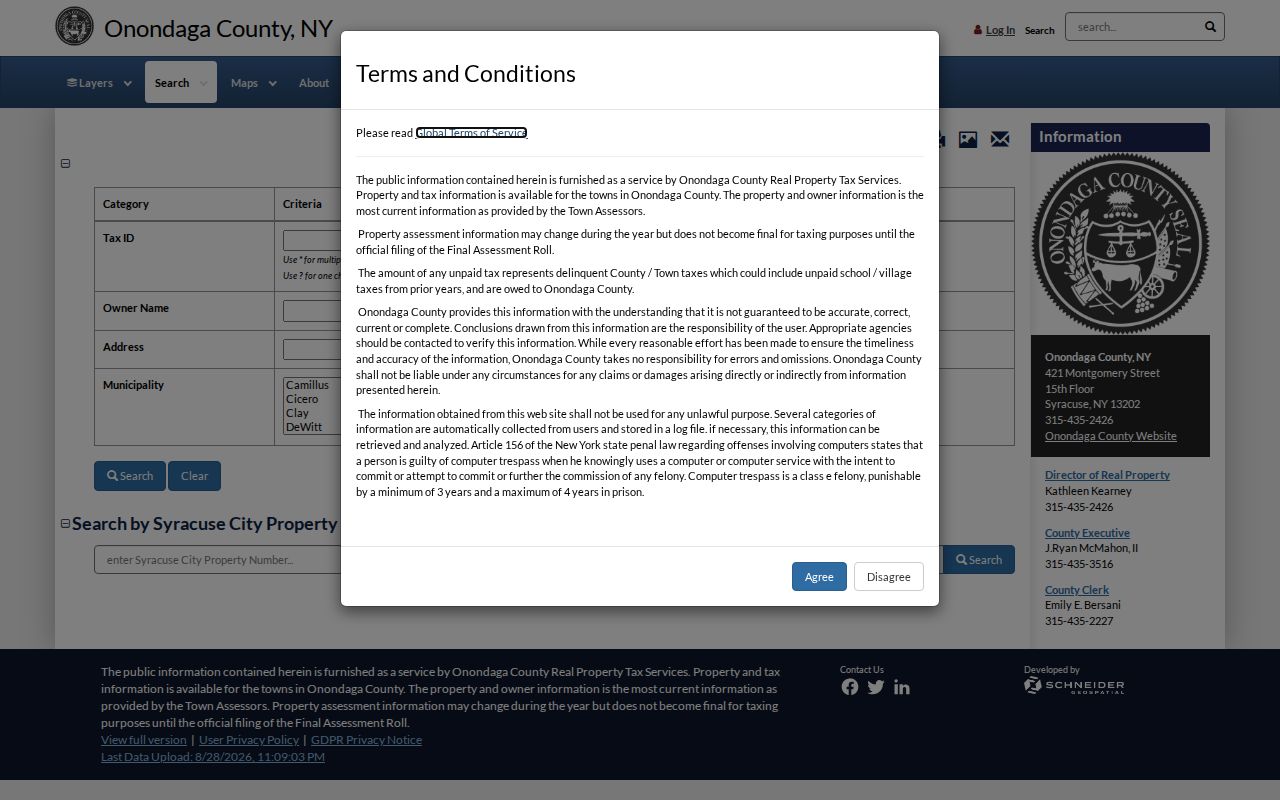
Image Mate Online is the local property route identified with a ZIP narrowing field. Begin with one item, such as an owner name, property address, or parcel identifier. Add ZIP only after a broad return needs narrowing. That order follows the service's warning that over-specifying a search can suppress a match.
The Image Mate access screen shows the public entry point for tax-bill and property-search instructions.
Once a result is found, preserve the parcel or tax-map identifier along with the situs address and municipality. A mailing address may be displayed for tax notices, but it can point to an agent or another location and does not establish residence at the parcel.
Find Residents Within a Syracuse ZIP
A ZIP can narrow several searches, but each source answers a different question. Property research starts with a full address or known owner. Registration checking begins with the individual identity information the state requires. Historic directories and city permit records are address or street keyed, so their value rises after the ZIP has been resolved to a house number.
- Confirm the complete address through USPS and record the returned ZIP, rather than relying on a static list.
- Search Image Mate by owner, situs address, or parcel ID first, then use ZIP to reduce an overly broad property result.
- Keep the municipality, situs address, and parcel ID with the result, since a Syracuse mailing label can extend beyond city limits.
- Move to the relevant city, county, or state record only after the address and jurisdiction are clear.
When the question becomes street-level rather than postal, the Syracuse street directory follows the address through parcel, map, deed, permit, and historical sources. A ZIP narrows the starting area; it does not replace that address-based record trail.
Syracuse's permit and code database is described as address and property keyed, with self-service data stated from 2011. A ZIP may help orient the search, but the record requires the street address or parcel context. For an earlier or missing city property record, use the FOIL route with the address, record type, and date range instead of asking for a ZIP-wide list.
Syracuse ZIP Checks in Voter Records
The New York Voter Lookup visibly asks for a last name, first name, date of birth, county, and ZIP in the static capture. It is an individual registration and poll-site check, not a way to create a ZIP-wide or block-wide resident list. The exact street-address field and the result fields were not stable in the text capture, so they should not be assumed.
| Visible lookup field | Format or use |
|---|---|
| Last Name | Required surname for the voter submitted. |
| First Name | Required first name for the voter submitted. |
| Date of Birth | Required in MM/DD/YYYY format. |
| County | Required New York county selection. |
| ZIP Code | Visible input, used with the person and county. |
A full voter-file request is different. New York requires a written request and an elections-purpose statement under Election Law §3-103(5). Election Law §3-220 keeps driver-license, non-driver ID, Social Security, and signature-type data out of the ordinary public registration record, while protected voters have additional safeguards.
Syracuse ZIP Code and City Limits
The key Syracuse mismatch is geographic. ZIP 13212 can carry a Syracuse mailing label while reaching North Syracuse or Salina-area geography. ZIP 13214 points toward DeWitt, and 13215 and 13219 can involve city-edge or county municipalities. A record request should go to the keeper tied to the parcel's municipality and subject, not automatically to City Hall because the address says Syracuse.
- ZIP and ZIP+4
- A ZIP identifies a delivery area. ZIP+4 adds a more specific delivery segment but does not define a parcel boundary.
- PO-box-style ZIP
- A code used for a postal delivery arrangement rather than a map of all nearby homes. The special Syracuse classifications need address-level confirmation.
- Unique ZIP
- A code used for a particular delivery arrangement or institution. The 13244 row should be verified with USPS, not assumed from the label.
- Carrier route
- A postal delivery grouping. It is not a city ward, a census of residents, or a legal description.
For any disputed location, compare the USPS result, municipal name, GIS parcel geometry, assessor situs address, and deed legal description. Those five keys describe related but different things. The parcel and deed, not the ZIP, establish the land record's legal location.
Syracuse Mailing Geography Over Time
Postal geography is only one layer of Syracuse history. The Town of Geddes records that its village of Geddes was annexed to the City of Syracuse on May 20, 1886. Older records can therefore use village, town, or Geddes language even when a later mailing address says Syracuse. Preserve the record's original jurisdiction and date before choosing an office or map.
This is especially useful for family history, an heir matter, or a historical streetscape question. Syracuse is the county seat, yet Onondaga County also contains towns and villages. A mailing city, parcel municipality, situs address, and legal description should remain separate notes instead of being blended into one assumed location.
Use Parcel IDs After a Syracuse ZIP
For property work, a ZIP is less exact than a tax-map or parcel identifier. County GIS can show parcel geometry and adjacent boundaries, while Image Mate supplies the property and tax context. The live GIS interface was dynamic during research, so its exact search controls, layer names, and identify-panel fields should be confirmed in the current viewer before relying on them.
After finding the parcel, use the legal description and owner history in the County Clerk's deed index when title research is needed. This avoids treating the current street number or ZIP as permanent evidence. Street renaming, annexation, subdivision, and differing mailing labels can all change the label without changing the underlying land description.